The 9th Hampden in Profile and in Springfield History…
Factories spurred many of the neighborhoods in the 9th Hampden. (via wikipedia)
By Michael Lachenmeyer
Correspondent-Intern
When the 9th Hampden District was first established, it covered several small rural communities to the south and west of Springfield proper, including the towns of Agawam, Southwick, and Granville. However, over the course of the late 19th century, the borders of the 9th Hampden District shifted eastward, until they finally moved into Springfield itself during the early 1900s.
Today, the 9th Hampden runs from Atwater Park in the west through Pine Point and then south to 16 Acres. The district also covers a single precinct of Chicopee’s 5th Ward, which forms its northernmost edge. In doing so, it reaches across the history, divides and diversity of the city.
Of the six State House districts that cover parts of Springfield, in only three—the 9th, 10th, and 11th—do the city and its voters dominate to the exclusion of any other community. Among those three, the 9th is by far the wealthiest and regularly boasts the highest voter turnout.
The seat is open after Jose Tosado announced his retirement. At-large School Committee member Denise Hurst, political activist Sean Mullan and Ward 8 Councilor Orlando Ramos are seeking the Democratic nomination for the seat. The primary September 1. The winner wil be overwhelmingly favored to win in November.
Like Springfield itself, the 9th Hampden District is a study in contrasts. Residential neighborhoods reminiscent of the nearby suburbs exist next to public housing projects and industrial zones. The district also has churches of numerous Christian denominations and even boasts a mosque and Jewish study hall. Immigrants from many different backgrounds call the area home and share their neighborhoods with a variety of native-born Americans.
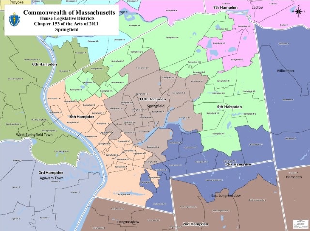
The 9th Hampden District (in bright green) snakes across the city. The 12th Hampden (violet) splits 16 Acres with the 9th Hampden. (via malegislature.gov)
According to the census bureau, the population of the 9th Hampden District is older than the rest of Springfield. Its median age is 36.1 compared with 32.9 in the rest of the city. The district’s population is also better educated than their peers, with 84.4% having achieved a high school diploma or higher compared with 77.4% in all of Springfield. The district also skews whiter than the rest of the city. In the 9th approximately 45% of the population is White, 37% is Hispanic, and 13% is African American. Meanwhile, in Springfield as a whole, the population is 31.7% White, 44.7% Hispanic, and 20.9% African American.
These demographic differences explain some of the gap between the 9th Hampden District and the rest of Springfield. Yet poverty remains a serious issue in the district. 18.3% of residents or nearly 1 in 5 live below the poverty line, which is much lower than Springfield’s average of 28.6%, yet it is still almost 7% higher than the Massachusetts average. Because of the outbreak of the novel coronavirus, this number has probably crept higher in recent months.
The diversity of the 9th Hampden District comes out in its neighborhoods. Perhaps the most affluent of these is Atwater Park, located on the far west side of the district. The area originally developed around the turn of the century, when the sons of George Atwater, founder of the Springfield Street Railway, turned his 300-acre estate into a residential neighborhood. Atwater Park’s central location between what became Van Horn Park and Atwater Park, in addition to its proximity to the Springfield Hospital (now known as Baystate Medical Center), helped spur its growth.
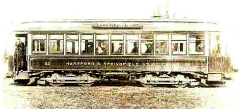
It’s good to be Trolley Master! (via atwaterpark.org)
Today, Atwater Park best-known features is its well-planned streets and well kept Colonial and Tudor Revival style houses. Many of the neighborhood’s current residents work at Baystate Medical Center or as executives in Springfield’s major industries. However, the area is also home to several of Springfield’s most prominent politicians, legal figures and business people. Among them are Congressman Richard Neal and City Councilor Michael Fenton.
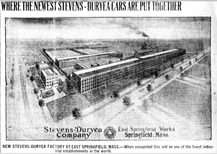
Meanwhile, just two miles to the east of Atwater Park, most of the city’s heavy industry and many of its blue-collar residents reside in East Springfield. This neighborhood is one of the city’s newest. It originally developed around 1902 as the offshoot of an automobile factory owned by the Stevens-Duryea Company. In 1915, the New England Westinghouse Co. (a former subsidiary of Westinghouse Electric Co). purchased the facility and retooled it to help produce 1.8 million Mosin Nagant rifles for the Imperial Russian Army during World War I. This activity brought even more families to East Springfield.
Yet, in 1917, a black-market weapons scandal involving Westinghouse and the British government almost brought gun production to a halt. The New England Westinghouse Co. never recovered from it and in 1920, Westinghouse Electric Co. decided to begin producing consumer products rather than guns in East Springfield. The factory survived in this form for approximately 40 years. It reached its apex during World War II when some 7,000 people worked there.
Around the end of World War II, Smith and Wesson also moved its headquarters and production center to East Springfield. This move significantly aided East Springfield’s development. However, In 1970, the Westinghouse plant was shuttered marking the end of an era for the community. For decades the old complex stood vacant until the city demolished it in 2010.
Then in 2014, CRRC Changchun Railway Vehicles Company purchased the lot and built a new factory there to produce railcars for the Boston public transit system. These days, East Springfield remains home to industrial giants—Smith and Wesson and CRRC Changchun—as well as several logistics centers, and paper companies among others.
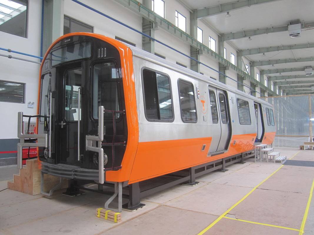
A sample of rail car CRRC supposedly makes. (courtesy MBTA via Boston Herald)
According to Kathleen Brown, President of the East Springfield Neighborhood Council, the area boasts a racially diverse group of residents. However, many share similar concerns. Financial instability and unruly street traffic are two problems that seem to cut across the neighborhood. Brown also stated her hope that local government officials would communicate more with East Springfield’s residents about their issues.
Finally, in the far southwest corner of the district sits Sixteen Acres. Originally deriving its name from a farmstead, the area quickly developed into an important crossroads that connected East Longmeadow, Wilbraham, Indian Orchard, and Springfield. According to City Councilor Timothy Allen, the area developed into a suburban-style residential neighborhood after World War II.
Although the 9th and 12th Hampden Districts divide Sixteen Acres, the former encompasses the center of this politically key community. According to Councilor Allen, the area’s defining attributes are its beautiful, well-kept neighborhoods, consistently high voter turnout, high property taxes, and the expectation that local authorities will provide good services for its residents.
Like all State House seats, the 9th Hampden District only represents about 40,000 people. However, across its neighborhoods, one can find the threads that make the city unique. Some even echo the history that still characterizes Springfield’s contrast between rich and poor.
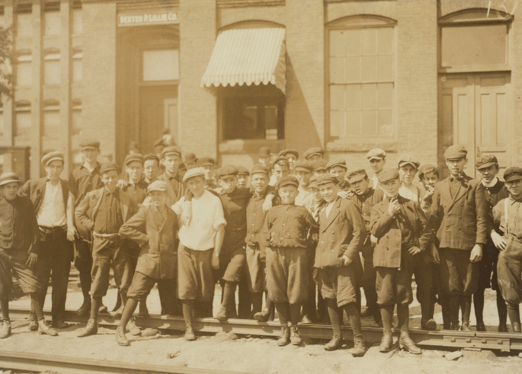
Child laborers in Springfield (via. loc.gov/LostNewEngland.com)
In 1911, the famous photographer Lewis Hine was working on behalf of the National Child Labor Committee when he traveled to Indian Orchard to take pictures of the kids who worked at the mill there. Even when Springfield was at its most prosperous, there were still vast disparities that divided the city’s residents.
Come September, whoever voters elect to replace José Tosado should keep those disparities in mind when they go to Beacon Hill. Every resident of the district deserves representation, not just those living in a few high turnout neighborhoods.